“Operational Landfast Sea Ice Mapping in Svalbard” Project Selected for Arctic Phi-Lab
The Norwegian Geotechnical Institute (NGI), in partnership with the Norwegian Ice Service (NIS) at the Norwegian Meteorological Institute and the Alfred Wegener Institute (AWI), is proud to announce that its project, “Operational Landfast Sea Ice Mapping in Svalbard,” has been accepted to the ESA Phi-Lab Norway program. This initiative marks a major leap forward in the continuous, high-resolution monitoring of landfast sea ice (LSI) in the Arctic—a critical need for science, industry, and society.
Project Overview
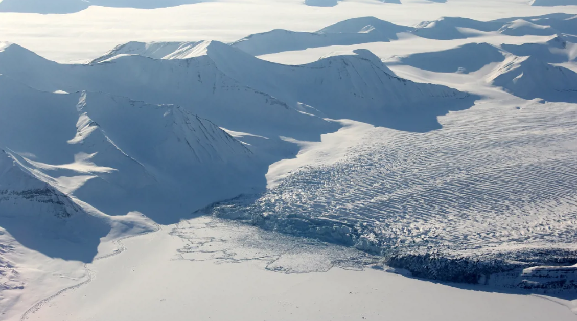
Landfast sea ice (LSI) is a vital component of Arctic coastal environments, influencing everything from heat exchange and subsea permafrost aggregation to the safe passage of ships and the logistics of local communities. Yet, until now, there has been no operational, pan-Arctic dataset or continuous mapping of LSI, largely due to the technical challenges of distinguishing LSI from stationary pack ice using satellite data.
The project will develop and implement an automatic workflow for mapping and monitoring LSI using Synthetic Aperture Radar Interferometry (InSAR). Building on recent advances by the project team, the new system will deliver high-resolution, frequently updated LSI maps for Svalbard, with the potential for expansion across the Arctic.
Why This Matters
- Safety and Logistics: LSI serves as a platform for over-ice travel, supports industrial operations, and can block or enable port access. Accurate, timely mapping is essential for shipping companies, national defense, energy operators, and local governments.
- Environmental Monitoring: LSI plays a key role in coastal processes, subsea permafrost formation, and even greenhouse gas regulation. The new dataset will enable unprecedented monitoring of these critical zones.
- Scientific Advancement: For the first time, stakeholders will have access to operational-quality LSI maps, supporting research, environmental management, and policy decisions.
Key Innovations
- Automatic InSAR-Based Mapping: The project will operationalize algorithms for LSI detection and classification, enabling continuous, automatic updates based on the latest satellite acquisitions.
- Validation and Integration: The system will be validated using field data from AWI and the Norwegian Polar Institute, and integrated with the Norwegian Ice Service’s operational workflows.
- Open and Custom Data Products: While the Svalbard dataset will be open for demonstration and research, the underlying processing chain will be protected, allowing for custom, commercial LSI mapping services across the Arctic.
Societal and Commercial Impact
- Stakeholder Benefits: The service will support shipping, energy, defense, research, and local communities—improving safety, reducing costs, and enabling better planning in a rapidly changing Arctic.
- Climate and Sustainability: The project will provide essential data for climate change monitoring, support sustainable Arctic development, and help preserve traditional lifestyles by improving safety for indigenous and local communities.
- Market Potential: The team will explore business models ranging from custom, high-resolution mapping for industry to subscription-based regional datasets and tiered data access for a broad user base.
Strong Partnerships and Support
The project is backed by letters of support from KSAT, UNIS, NERSC, SIOS, and the Norwegian Ice Service, reflecting broad interest and demand for operational LSI mapping. The team brings together leading expertise in remote sensing, sea ice physics, and Arctic operations, ensuring both scientific rigor and practical relevance.
Project Timeline and Management
The project will run from early 2025 through the end of 2026, with key milestones including the development of the automatic mapping workflow, validation and statistical analysis, operationalization, and dissemination of results at major Arctic conferences. NGI will lead the project, supported by a robust management and risk mitigation framework.
About the Norwegian Geotechnical Institute (NGI)
NGI is Norway’s leading center for geoscience research and innovation, with a long history of Arctic engagement. NGI’s expertise spans geotechnics, environmental monitoring, climate adaptation, and digitalization, making it uniquely positioned to lead this transformative project.
For more information, contact Project Manager Dyre Oliver Dammann (Dyre.Dammann@ngi.no) or visit https://www.ngi.no/.